

Stumbling blocks on the way to the construction of a £30m road serving thousands of houses yet to be built have disappeared.
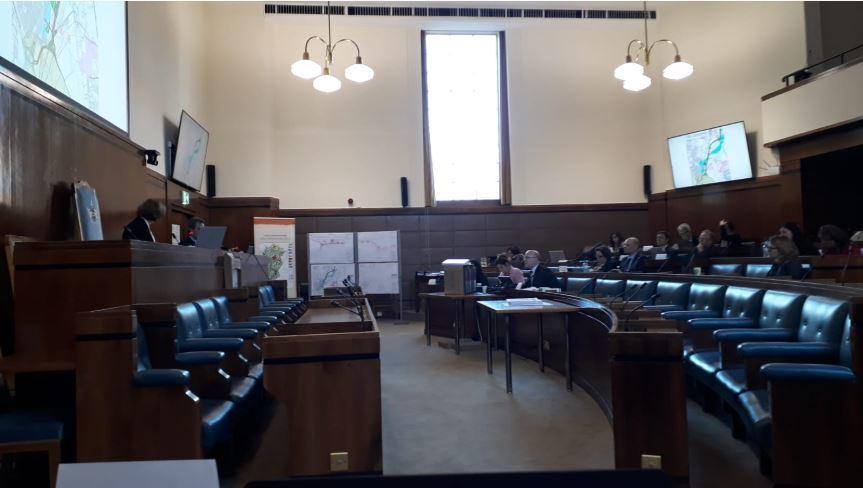
On the first day of a public inquiry into Swindon’ Borough Council’s plan to make compulsory purchases of several parcels of land from different owners to construct the southern connector road for the 8,000 house New Eastern Villages expansion, it was confirmed most objections have been dropped.
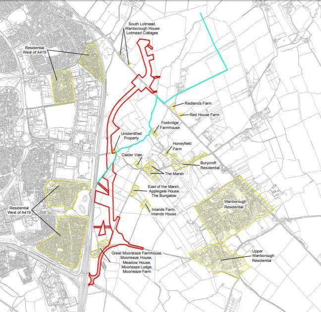
Included in those people reconciled to the scheme are ten landowners whose property towards the southern end of the route of the road as it approaches the Commonhead Roundabout.
They had wanted to be compensated for land between the A419 and the road which would be cut off from the rest of their agricultural land, which is mainly used for grazing stock.
They were all represented by George Paton of WebbPaton, chartered surveyors based in Royal Wotton Bassett.
Mr Paton said the council and his clients had come to an agreement after a number of years of discussion, and he declined to comment further.
The government-appointed inspector Karen Ridge opened the hearing at the council chamber in Euclid Street.
She said she would be making the final decision on whether the council would be allowed to buy the land - and said: “I want to know about planning permission for this scheme and the NEV development, I need to know it's realistic and likely to come forward in good time and that funding is available."
The borough council’s lawyer Richard Harwood QC said: “There is a compelling case in the public interest for the acquisition of the land.”
He said it was critical for the southern reaches of the New Eastern Villages developments and added: “There is no alternative to taking a southern route to the Commonhead Roundabout and half of the NEV could not come forward without the road."
He added there was nothing to stop the councils' ability to start work: planning permission had been granted and full funding for the scheme had bee acquired from central government grants and developer contributions.
Highways designer Amin Saadaie told the inspector the road had been designed to cross a flood zone at its narrowest point, and avoided woodlands, farm buildings and all but one area of archaeological interest.
The hearing is expected to last a number of days and the inspector's decision will be made public in several weeks' time.


Comments: Our rules
We want our comments to be a lively and valuable part of our community - a place where readers can debate and engage with the most important local issues. The ability to comment on our stories is a privilege, not a right, however, and that privilege may be withdrawn if it is abused or misused.
Please report any comments that break our rules.
Read the rules hereLast Updated:
Report this comment Cancel